Bruidegomskraal
Place in North West, South Africa
26°10′58″S 26°54′47″E / 26.18278°S 26.91306°E / -26.18278; 26.91306 (2011)[1]
2710
2710
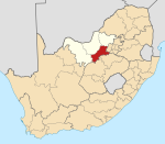
Bruidegomskraal is a 99% Black African village in Dr Kenneth Kaunda District Municipality, North West Province, South Africa. It is situated north of Ventersdorp on the R30 road to Derby.
References
- ^ a b c d "Main Place Bruidegomskraal". Census 2011.
- v
- t
- e
Municipalities and communities of Dr Kenneth Kaunda District Municipality, North West
District seat: Klerksdorp