Herveld
Village in Gelderland, Netherlands
51°54′N 5°45′E / 51.900°N 5.750°E / 51.900; 5.750 (2021)[1]
6674[1]
Herveld is a village in the Dutch province of Gelderland. It is located in the municipality of Overbetuwe.
Herveld was a separate municipality until 1818, when the area was divided between Loenen en Wolferen and Valburg.[3]
The village exists of two semi-separate communities of Herveld-Noord and Herveld-Zuid.,[4] connected by the Stenenkamerstraat. The mostly Catholic Herveld-North is located directly east of the village Andelst while the more Protestant Herveld-South is a mile further south. Most amenities such as supermarkets, are located in Herveld-North.
In the center of Herveld-South is a Gothic hall church, dating from the 15th century. Just outside the village is De Vink, a mill from the 18th century. Herveld is just off the A50 motorway (junction/knooppunt Valburg), and to come into the village, one must follow the A15.
Herveld has a rich history of fruit cultivation.[5]
Gallery
-
 House in Herveld
 -
 Gate for Queen's Day
 -
 Statue
 -
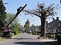
 Tree plantation


References
- ^ a b c "Kerncijfers wijken en buurten 2021". Central Bureau of Statistics. Retrieved 24 March 2022.
- ^ "Postcodetool for 6674AA". Actueel Hoogtebestand Nederland (in Dutch). Het Waterschapshuis. 24 July 2019. Retrieved 24 March 2022.
- ^ Ad van der Meer and Onno Boonstra, "Repertorium van Nederlandse gemeenten", KNAW, 2006. "KNAW > Publicaties > Detailpagina". Archived from the original on 2007-02-20. Retrieved 2009-12-03.
- ^ ANWB Topografische Atlas Nederland, Topografische Dienst and ANWB, 2005.
- ^ "Fruit- en boomteelt bundelen krachten tegen drinkwaterwinning". De Gelderlander (in Dutch). Retrieved 24 March 2022.
| Authority control databases: Geographic |
|
|---|
 | This Gelderland location article is a stub. You can help Wikipedia by expanding it. |
- v
- t
- e


