Karmrakar
40°52′N 43°53′E / 40.867°N 43.883°E / 40.867; 43.883
Place in Shirak, Armenia
Karmrakar Կարմրաքար | |
|---|---|
 | |
  Karmrakar 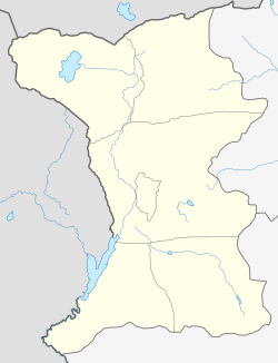 Karmrakar | |
| Coordinates: 40°52′N 43°53′E / 40.867°N 43.883°E / 40.867; 43.883 | |
| Country | Armenia |
| Province | Shirak |
| Municipality | Akhuryan |
| Population (2001) | |
| • Total | 52 |
| Time zone | UTC+4 |
| • Summer (DST) | UTC+5 |
Karmrakar (Armenian: Կարմրաքար) is a village in the Akhuryan Municipality of the Shirak Province of Armenia.
Village mayor: Artur Matevosyan
Demographics
| Year | Pop. | ±% p.a. | |
|---|---|---|---|
| 1831 | 162 | — | |
| 1897 | 388 | +1.33% | |
| 1926 | 236 | −1.70% | |
| 1939 | 364 | +3.39% | |
| 1959 | 285 | −1.22% | |
| 1970 | 131 | −6.82% | |
| 1979 | 50 | −10.15% | |
| 1989 | 34 | −3.78% | |
| 2001 | 52 | +3.60% | |
| 2004 | 86 | +18.26% | |
| |||
| Source: [1] | |||
References
- ^ Հայաստանի Հանրապետության բնակավայրերի բառարան [Republic of Armenia settlements dictionary] (PDF) (in Armenian). Yerevan: Cadastre Committee of the Republic of Armenia. 2008. Archived from the original (PDF) on 11 March 2018.
- Karmrakar at GEOnet Names Server
- Report of the results of the 2001 Armenian Census, Statistical Committee of Armenia
- v
- t
- e
 Shirak Province
Capital: Gyumri

 | This article about a location in Shirak Province, Armenia is a stub. You can help Wikipedia by expanding it. |
- v
- t
- e


