Leeuwergem
Village in Flemish Region
50°53′N 3°49′E / 50.883°N 3.817°E / 50.883; 3.817 Belgium
 (2021)[1]
Leeuwergem is a village belonging to the municipality of Zottegem. It is located on the Molenbeek, in the Denderstreek and Flemish Ardennes, which is part of the hilly southern part of the East Flanders province, Belgium.
Leeuwergem used to be part of the heerlijkheid of Zottegem. From 1271 onwards, it formed a heerlijkheid with Massemen.[2] It was an independent municipality until 1970, when it was merged into Zottegem.[3]
Leeuwergem and the neighbouring village of Elene host the 18th-century Leeuwergem Castle domain, a private estate of 32 hectares.[4]
Gallery
-
 View on the St Amandus Church
 -
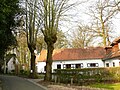 Farm in Leeuwergem
 -
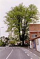 Seven sacraments tree
 -
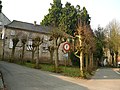 House in Leeuwergem


References
- ^ a b "Bevolking per statistische sector - Sector 41081C". Statistics Belgium. Retrieved 5 May 2022.
- ^ "Leeuwergem". Agentschap Onroerend Erfgoed (in Dutch). Retrieved 5 May 2022.
- ^ "Zottegem". Agentschap Onroerend Erfgoed (in Dutch). Retrieved 5 May 2022.
- ^ Koenraad DE WOLF and Ignace DE TEMMERMAN, Het parkdomein van Leeuwergem: een historische reconstructie, in "Monumenten en Landschappen", bimonthly of the Ministry of Flanders, Division of Monuments and Landscapes, edition 19/3, Brussels, May–June 2000, pp. 6-27.
External links
 Media related to Leeuwergem at Wikimedia Commons
- Webpage about Leeuwergem Castle at Internet Archives
- v
- t
- e
Belgian municipality Zottegem
- Elene [nl]
- Erwetegem
- Godveerdegem
- Grotenberge
- Leeuwergem
- Oombergen [nl]
- Sint-Goriks-Oudenhove
- Sint-Maria-Oudenhove
- Strijpen [nl]
- Velzeke-Ruddershove
- Zottegem
 Category
- Commons
 Belgium Portal


 | This East Flanders location article is a stub. You can help Wikipedia by expanding it. |
- v
- t
- e


