Millgrove Township, Steuben County, Indiana
Township in Indiana, United States
41°44′05″N 85°08′12″W / 41.73472°N 85.13667°W / 41.73472; -85.13667 (2020)[2]
Millgrove Township is one of twelve townships in Steuben County, Indiana, United States. As of the 2020 census, its population was 1,619, up from 1,577 at 2010,[3] and it contained 960 housing units.
History
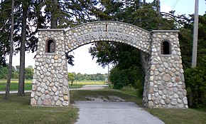
Fawn River State Fish Hatchery was listed on the National Register of Historic Places in 1997.[4]
Geography
According to the 2010 census, the township has a total area of 23.74 square miles (61.5 km2), of which 22.03 square miles (57.1 km2) (or 92.80%) is land and 1.71 square miles (4.4 km2) (or 7.20%) is water.[3] Lakes in this township include Bell Lake, Brown Lake, Chair Factory Lake, Lake Gage, Lake Syl-van, Lime Lake, Lime Lake, Perch Lake, Rhodes Lake, Sally Owen Lake, Tamarack Lake and Warner Lake. The stream of Crooked Creek runs through this township.
Cities and towns
Unincorporated towns
- Panama at 41°42′23″N 85°06′27″W / 41.7064392°N 85.1074684°W / 41.7064392; -85.1074684
(This list is based on USGS data and may include former settlements.)
Cemeteries
The township contains three cemeteries: Carlton, Greenlawn and Mill Grove.
Major highways


References
- U.S. Board on Geographic Names (GNIS)
- United States Census Bureau cartographic boundary files
- ^ "US Board on Geographic Names". United States Geological Survey. October 25, 2007. Retrieved May 8, 2017.
- ^ "Census Bureau profile: Millgrove Township, Steuben County, Indiana". United States Census Bureau. May 2023. Retrieved April 2, 2024.
- ^ a b "Population, Housing Units, Area, and Density: 2010 - County -- County Subdivision and Place -- 2010 Census Summary File 1". United States Census. Archived from the original on February 12, 2020. Retrieved May 10, 2013.
- ^ "National Register Information System". National Register of Historic Places. National Park Service. July 9, 2010.
External links
- Indiana Township Association
- United Township Association of Indiana
Places adjacent to Millgrove Township, Steuben County, Indiana | |
|---|---|


