Netrawati Dabjong Rural Municipality
Rural Municipality in Province No. 3, Nepal
Place in Nepal
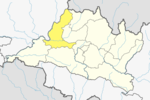
28°3′46.19″N 84°55′7.54″E / 28.0628306°N 84.9187611°E / 28.0628306; 84.9187611Netrawati Dabjong is a rural municipality in Dhading District of central Nepal.[1][2] The local body was formed by merging 3 VDCs namely Katunje, Semjong and Marpak. It has a total of five wards.
Demographics
At the time of the 2011 Nepal census, Netrawati Dabjong Rural Municipality had a population of 12,870. Of these, 56.8% spoke Nepali, 41.3% Tamang, 0.8% Ghale, 0.8% Gurung, 0.2% Newar and 0,1% other languages as their first language.[3]
In terms of ethnicity/caste, 48.9% were Tamang, 11.5% Chhetri, 8.8% Gurung, 7.4% Newar, 5.9% Hill Brahmin, 5.8% Magar, 5.6% Kami, 2.8% Damai/Dholi, 2.8% Ghale, 0.1% Badi and 0.3% others.[4]
In terms of religion, 54.9% were Buddhist, 44.0% Hindu, 1.0% Christian and 0.1% others.[5]
In terms of literacy, 62.4% could both read and write, 1.6% could read but not write and 35.9% could neither read nor write.[6]
Geography
East: Nuwakot District
West: Gangajamuna Gaupalika
North: Ruby Valley Gaupalika
South: Nilkhantha
References
- v
- t
- e
Headquarters: Dhading Besi
- Khaniyabas
- Gajuri
- Galchhi
- Gangajamuna
- Jwalamukhi
- Thakre
- Netrawati Dabjong
- Benighat Rorang
- Rubi Valley
- Siddhalek
- Tripurasundari
 | This article about a location in the Dhading District of Nepal is a stub. You can help Wikipedia by expanding it. |
- v
- t
- e


