Rouf, Athens
Neighborhood in Athens, Attica, Greece
Rouf Ρουφ | |
|---|---|
Neighborhood | |
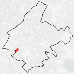 Location within Athens | |
| Coordinates: 37°58′25″N 23°42′13″E / 37.97361°N 23.70361°E / 37.97361; 23.70361 | |
| Country | Greece |
| Region | Attica |
| City | Athens |
| Postal code | 118 54, 177 78 |
| Area code | 210 |
| Website | www.cityofathens.gr |
Rouf (Greek: Ρουφ pronounced [ˈɾuf]) is a neighborhood of Athens, Greece. It is located to the west of the Athens centre, between Piraeus and Petrou Ralli Avenue. Rouf is named after a Bavarian businessman who, during Otto's reign, bought large areas in this location to make a farm. When the railway passed through this area, the local station was named Rouf.[1] During the interwar period, a camp was built in Rouf. In 1947, the local team of Rouf was founded under the name Asteras Rouf and later renamed to PAO Rouf.[2]
References
Places adjacent to Rouf, Athens | ||||||||||||||||
|---|---|---|---|---|---|---|---|---|---|---|---|---|---|---|---|---|
| ||||||||||||||||


- v
- t
- e
Neighbourhoods in municipality of Athens
- Agios Eleftherios
- Agios Panteleimonas
- Akadimia
- Akadimia Platonos
- Acropolis
- Ampelokipoi (Kountouriotika)
- Asyrmatos
- Asteroskopeio
- Attiki
- Ellinoroson
- Erythros Stavros
- Exarcheia
- Gazi
- Girokomeio
- Gyzi
- Goudi
- Gouva
- Ilisia
- Keramikos
- Kolokynthou
- Kolonaki
- Kolonos
- Koukaki
- Kypriadou
- Kypseli
- Kynosargous
- Metaxourgeio
- Mets
- Monastiraki
- Nea Filothei
- Neapoli
- Neos Kosmos
- Omonoia
- Pangrati (Kallimarmaro)
- Patisia
- Pedion tou Areos
- Petralona
- Philopappou
- Plaka (Aerides, Anafiotika)
- Polygono
- Probonas
- Profitis Daniil
- Profitis Ilias
- Psyri
- Rizoupoli
- Rouf
- Sepolia
- Syntagma
- Thiseio
- Thymarakia
- Treis Gefyres
- Votanikos (Elaionas)
This Athens location article is a stub. You can help Wikipedia by expanding it. |
- v
- t
- e


